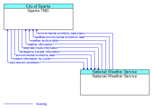
Interface: Sparks TMC - National Weather Service
Architecture Flow Definitions
alternate mode information (Existing) Applicable ITS Standards
Schedule information for alternate mode transportation providers such as air, ferry, and passenger–carrying heavy rail.
emergency traveler information (Existing) Applicable ITS Standards
Public notification of an emergency such as a natural or man–made disaster, civil emergency, or child abduction. This flow also includes evacuation information including evacuation instructions, evacuation zones, recommended evacuation times, tailored evacuation routes and destinations, traffic and road conditions along the evacuation routes, traveler services and shelter information, and reentry times and instructions.
environmental conditions data (Existing) Applicable ITS Standards
Current road conditions (e.g., surface temperature, subsurface temperature, moisture, icing, treatment status) and surface weather conditions (e.g., air temperature, wind speed, precipitation, visibility) as measured and reported by fixed and/or mobile environmental sensors and aggregated by the data collector. Attributes relating to the data collection (and aggregation) are also included.
environmental conditions data status (Existing) Applicable ITS Standards
Status of the data quality of environmental conditions data provided by a data contributor. Includes not only status by sensor, but statistical data regarding the quality checking of data provided.
incident information for public (Existing) Applicable ITS Standards
Report of current desensitized incident information prepared for public dissemination.
qualified environmental conditions data (Existing) Applicable ITS Standards
Current road conditions (e.g., surface temperature, subsurface temperature, moisture, icing, treatment status) and surface weather conditions (e.g., air temperature, wind speed, precipitation, visibility) that has had quality checks performed on it and has been formatted and consolidated by the Clarus system. Attributes relating to the data collection (and aggregation) are also included.
road network conditions (Existing) Applicable ITS Standards
Current and forecasted traffic information, road and weather conditions, and other road network status. Either raw data, processed data, or some combination of both may be provided by this flow. Information on diversions and alternate routes, closures, and special traffic restrictions (lane/shoulder use, weight restrictions, width restrictions, HOV requirements) in effect is included.
weather archive data (Existing) Applicable ITS Standards
Accumulated forecasted and current weather data (e.g., temperature, pressure, wind speed, wind direction, humidity, precipitation, visibility, light conditions, etc.) as well as qualified environmental sensor data. Content may include a catalog of available information, the actual information to be archived, and associated meta data that describes the archived information.
weather information (Existing) Applicable ITS Standards
Accumulated forecasted and current weather data (e.g., temperature, pressure, wind speed, wind direction, humidity, precipitation, visibility, light conditions, etc.).