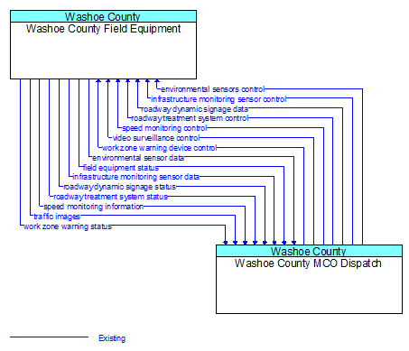
Interface: Washoe County Field Equipment - Washoe County MCO Dispatch
Architecture Flow Definitions
environmental sensor data (Existing) Applicable ITS Standards
Current road conditions (e.g., surface temperature, subsurface temperature, moisture, icing, treatment status) and surface weather conditions (e.g., air temperature, wind speed, precipitation, visibility) as measured and reported by fixed and/or mobile environmental sensors. Operational status of the sensors is also included.
environmental sensors control (Existing) Applicable ITS Standards
Data used to configure and control environmental sensors.
field equipment status (Existing) Applicable ITS Standards
Reports from field equipment (sensors, signals, signs, controllers, etc.) which indicate current operational status.
infrastructure monitoring sensor control (Existing) Applicable ITS Standards
Data used to configure and control infrastructure monitoring sensors.
infrastructure monitoring sensor data (Existing) Applicable ITS Standards
Data read from infrastructure–based sensors that monitor the condition or integrity of transportation infrastructure including bridges, tunnels, interchanges, pavement, culverts, signs, transit rail or guideway, and other roadway infrastructure. Includes sensor data and the operational status of the sensors.
roadway dynamic signage data (Existing) Applicable ITS Standards
Information used to initialize, configure, and control dynamic message signs. This flow can provide message content and delivery attributes, local message store maintenance requests, control mode commands, status queries, and all other commands and associated parameters that support remote management of these systems.
roadway dynamic signage status (Existing) Applicable ITS Standards
Current operating status of dynamic message signs, highway advisory radios, or other configurable field equipment that provides dynamic information to the driver.
roadway treatment system control (Existing) Applicable ITS Standards
Control data for remotely located, automated devices, that treat the road surface (e.g., de–icing applications).
roadway treatment system status (Existing) Applicable ITS Standards
Current operational status of automated roadway treatment devices (e.g., anti–icing systems).
speed monitoring control (Existing) Applicable ITS Standards
Information used to configure and control automated speed monitoring, speed warning, and speed enforcement systems.
speed monitoring information (Existing) Applicable ITS Standards
System status including current operational state and logged information including measured speeds, warning messages displayed, and violation records.
traffic images (Existing) Applicable ITS Standards
High fidelity, real–time traffic images suitable for surveillance monitoring by the operator or for use in machine vision applications. This flow includes the images and meta data that describes the images.
video surveillance control (Existing) Applicable ITS Standards
Information used to configure and control video surveillance systems.
work zone warning device control (Existing) Applicable ITS Standards
Data used to configure and control work zone safety monitoring and warning devices.
work zone warning status (Existing) Applicable ITS Standards
Status of a work zone safety monitoring and warning devices. This flow documents system activations and includes additional supporting information (e.g., an image) that allows verification of the alarm.